
For many people, off-grid living has always carried a certain promise. The promise is not only about producing your own power or collecting your own water, but also about stepping away from systems that feel crowded, tracked, and increasingly intrusive. When someone imagines building a cabin far from the city, it is easy to believe that distance alone creates privacy and that the further you go, the harder it becomes for anyone to find you.
However, that belief is starting to break down in a world where maps are no longer simple paper tools. Modern mapping is now tied to national security, emergency response, military planning, and advanced surveillance systems that do not require anyone to ever set foot near your property. This is where the uncomfortable reality begins, because off-grid does not always mean invisible anymore.
Off-Grid Living Is Not As Hidden As It Used To Be
Years ago, living off-grid often meant living outside of view. Remote areas were harder to access, fewer records existed, and the sheer emptiness of the landscape created natural privacy. Today, that privacy is much thinner, even in places that feel untouched.
Satellite imagery has become sharper, more frequent, and automated. Remote valleys, forest clearings, and desert structures can be seen from above with surprising detail. Even if a location is not well known locally, it can still appear in databases that track terrain, buildings, roads, and changes in the environment. This means that the idea of being “off the map” is becoming less realistic, even for people who truly live far from modern infrastructure.
Why Would the Pentagon Care About Remote Locations?
 At first, the idea sounds strange. Most off-grid homesteaders are not doing anything illegal, and they are not threats to anyone. So why would the Pentagon be involved at all?
The answer is that the Pentagon does not think in terms of personal lifestyle choices, but they see it as strategic awareness. Military agencies monitor geographic information because terrain matters during emergencies and conflicts.
And in recent years, this strategic awareness has gone far beyond satellites and aircraft. The Pentagon has openly tested high-altitude surveillance balloons over parts of the United States, floating at the edge of the stratosphere and quietly watching entire regions at once.
These systems were designed to track movement patterns, vehicles, and activity across hundreds of miles, proving that wide-area monitoring no longer depends on drones, planes, or boots on the ground.
Certain areas are considered sensitive, and certain types of infrastructure, even private infrastructure, can become part of larger mapping concerns. In some cases, locations are removed or blurred from public-facing maps because they are too close to training sites, critical facilities, or restricted zones. The goal is not always about targeting individuals, but about controlling what is visible to the public and what is not.
For anyone living remotely, the disturbing takeaway is simple: distance no longer protects you when observation can come from directly above, day after day, without anyone knowing it’s there.
When Emergency Mapping Turns Your Private Land Into Government Data
One of the least discussed reasons remote locations attract government attention is emergency planning. Wildfires, floods, earthquakes, and severe storms force agencies to map every structure they can find, especially in hard-to-reach areas. When disasters happen, responders cannot afford guesswork, so they rely on satellite scans, terrain models, and updated structure databases to understand what exists on the ground.
Is Your House a Burglar Magnet?
There are real cases where off-grid cabins were discovered and cataloged during wildfire mapping operations in the western United States. These structures were not targeted, but once identified, they were added to emergency response systems. That information did not disappear after the fires ended. It became part of a permanent geographic record used by multiple agencies.
If you are an off-grid homeowner, this matters because emergency mapping does not ask for permission. If your cabin exists, it can be logged. If it is logged, it can be shared. Over time, a location that once felt unknown becomes a data point inside systems designed for national-scale planning.
Military Training Zones Are Expanding Into Remote Areas

Another reason the Pentagon tracks remote locations is that military training increasingly takes place far from cities. Large stretches of rural land are used for flight exercises, navigation drills, and terrain simulations.
These areas often overlap with regions favored by off-grid homesteaders because they are sparsely populated and difficult to access.
A real-world example that raised public awareness of this issue was the 2015 military exercise known as Jade Helm 15.
The training operation took place across several southwestern states, including Texas, Arizona, and New Mexico, and it involved special operations forces conducting realistic drills over wide rural regions. Although the exercise was officially described as preparation for overseas deployments, many residents were surprised to learn how much military activity could occur so close to remote private land.
When areas become part of military planning, even temporarily, they often receive more attention from surveillance systems, aviation safety databases, and geographic monitoring tools.
In several documented cases, landowners discovered that their property was close to newly designated training corridors or restricted airspace. While their homes were not seized, public map visibility around those zones changed. Some structures were removed from consumer map platforms, while others were flagged internally for operational awareness.
This creates a strange situation where an off-grid location may still physically exist but becomes less visible to the public. The decision is strategic. When military planning shifts, the map shifts with it, and private land can be affected without warning.
To understand how the military think when they participate in such experiments, you should check out these SEAL-Tested survival skills that will hep you survive the next crisis. For example, you will find out how to avoid deadly bug-in mistakes, what will become extremely valuable after an EMP, and where to find shelter in the event of a nuclear strike… And this is not even half of it. Find out more here.
Technology Finds Patterns Humans Used to Miss
Perhaps the most unsettling change is how pattern detection works today. In the past, someone had to notice a cabin or road manually. Now software does the noticing. Algorithms compare satellite images over time and highlight changes that stand out from the surrounding terrain.
For example, a clearing in a forest that slowly expands, a new access path that cuts across undeveloped land, or a roof that reflects heat differently than natural surroundings can all trigger automated attention. These systems were designed for defense and intelligence purposes, but they also capture civilian activity by default.
There are real-world examples of remote properties being flagged simply because they appeared unusual compared to nearby land. No crime was involved, but the locations were reviewed, logged, and stored for reference. This shows how off-grid life can unintentionally draw attention, even when the goal is privacy.
Off-Grid Privacy Is Becoming Harder to Maintain
Many people choose off-grid life because they want control. They want fewer systems involved in their daily survival. They want independence. Yet privacy is now tied to technologies that most individuals cannot opt out of.
Mapping systems are constantly updated. Drones are increasingly common in disaster assessment. Government agencies share geographic data with one another for planning purposes. Even public map services often rely on the same underlying satellite sources used by defense and intelligence organizations.
This creates a future where the blank spaces on the map are shrinking. The world is being documented more completely each year, and remote living no longer guarantees obscurity.
The Real Issue Is Visibility, Not Presence
 One of the biggest misconceptions about modern surveillance is that someone has to physically visit a place for it to be known. That is no longer true. Visibility today is often created digitally.
A structure that appears in satellite imagery can be flagged automatically. A new road cut through the trees can show up as a change in terrain.
Even something as simple as a cleared patch of land can draw attention because algorithms are designed to detect unusual developments in remote regions.
This is what makes the situation unsettling for people who believe distance equals privacy. You may never see a government vehicle near your property, but that does not mean your location is unknown.
What This Means for You
If you take privacy seriously, the biggest mistake you can make is assuming that remoteness automatically equals safety. The world has changed, and locations that feel hidden on the ground can still be visible through mapping systems, emergency databases, and long-term surveillance tools. This does not mean off-grid living is pointless, but it does mean you need to think in terms of reducing attention rather than expecting total invisibility.
There are a few practical steps that can help keep your home from standing out unnecessarily.
- Avoid large clearings and obvious land changes, because those show up clearly in satellite history.
- Keep access routes subtle, using existing trails instead of cutting straight new paths.
- Build in ways that blend with the terrain, so your structure looks natural rather than isolated and exposed.
- Limit highly reflective surfaces, including oversized solar arrays that can be spotted easily from above.
- Reduce unnecessary digital connections, such as deliveries, registrations, or services tied directly to your location.
- Be cautious with constant lighting or strong signals, since these confirm ongoing activity even in remote areas.
- Know what surrounds you, especially military training corridors, restricted airspace, and emergency mapping zones.
But even these methods only go so far. They help in the short term, yet there is one step you must take if you truly want to protect your property and your privacy. It is completely legal, but it may feel controversial, because it runs against the habits and assumptions most people never question.
This is the best way to completely stay off the Government’s radar:

Here’s the detail most people don’t realize until it’s too late.
Once your property shows up in a database or satellite record, it never truly disappears again. From that point on, privacy depends less on distance and more on how much you still rely on the outside world.
In a long emergency, the fastest way to become exposed is having to leave home for food, supplies, or basic survival.
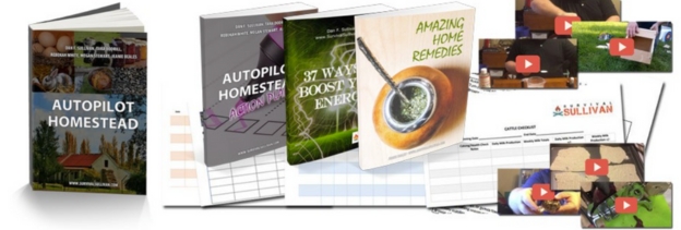
Autopilot Homestead is built around the simplest way to remove that dependency, by showing you how to grow your own groceries, preserve what you produce, and build a long-term stockpile that doesn’t rely on stores or supply chains.
If you want a food system that keeps you steady when everything else becomes uncertain, you can start here:
Final Thoughts
The most important question is not whether the Pentagon is personally interested in your cabin. The real question is what happens when governments and large systems decide which places stay visible, which places get blurred, and which places become part of a bigger security picture.
Off-grid living is still possible, and it is still a powerful form of independence. However, the world has changed, and the map is no longer just a map. It is a living system of surveillance, data, and control that continues to grow.
If you want to live off-grid today, you should still build, prepare, and protect your family, but you should do it with open eyes. The wilderness may still give you space, but it does not guarantee secrecy anymore.
You may also like:
 7 “Safe” US States That Might Soon Be a Target
UN Warns That a Super Famine Is Coming in the Next Few Years (VIDEO)
The Most Overlooked Medical Supplies You Need
Big Tech Is Watching You
How to Turn Your Dead Smartphone into a Survival Tool
Read the full article here